CBS News Live
CBS News Colorado: Local News, Weather & More
Watch CBS News
Covering Colorado First
About 2.5% of Colorado's unemployment claims are currently held up on program integrity holds. That's almost 3,000 claims still in limbo, out of the 114,400 active unemployment claims in the state.

One of the largest dams built in the United States in the last two decades is one year away from completion, a dam which will help supply water to Northern Coloradans for decades to come.
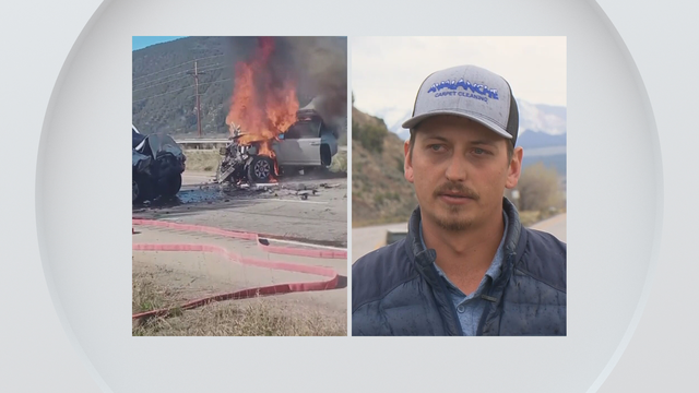
Alec Larson, a carpet cleaner and former volunteer firefighter, was among several good Samaritans who helped save a mother and young child from a burning car moments before it blew up. His act of bravery came five years after his own daughter died.
Families of those who were lost shared say on this day of remembrance they want to focus on the positive changes that have been made since that horrific day.
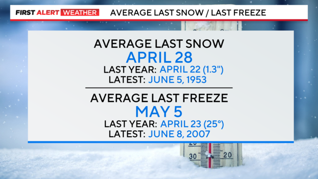
Denver's average last freeze is just over three weeks away.
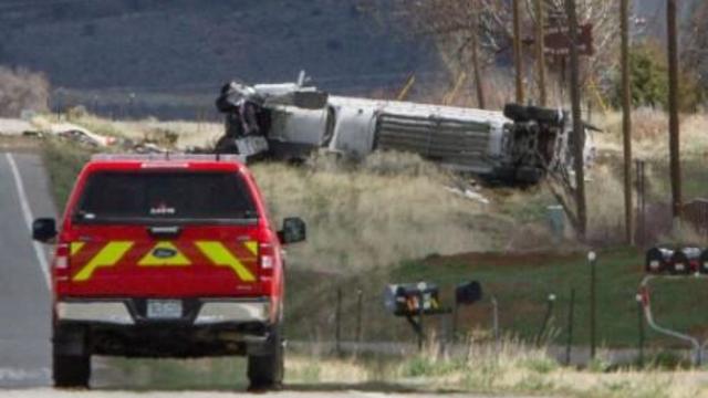
A tractor-trailer hauling liquified natural gas crashed just after 11 a.m. Monday near the Colorado-New Mexico state line. Several homes have been evacuated.
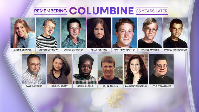
The Columbine High School shooting took place on April 20, 1999, and 25 years later the memories of the people who were killed live on.
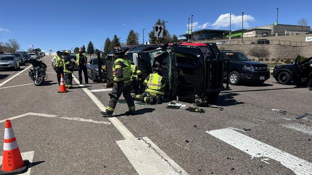
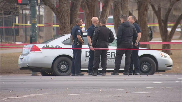
A battalion chief with South Metro Fire Rescue was involved in a crash that sent two people to the hospital.
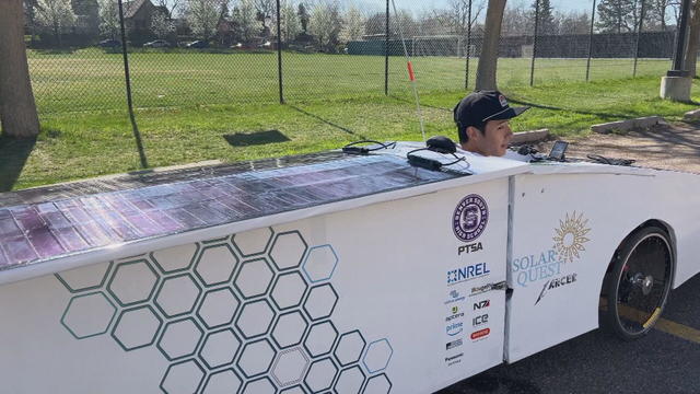
A group of student engineers from Denver South High School are seeing the fruits of their labor as a years-long project comes to life. They're getting ready to take their modified and solar-powered bike on its maiden journey.
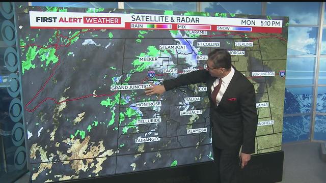
Watch Dave Aguilera's Forecast

It's that time of year, and Colorado Avalanche fans get to look forward to post-season hockey without having to sweat out the last few days of the regular season.
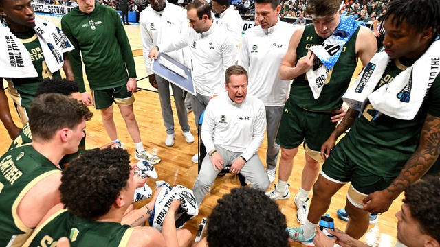
The Rams announced that they've reached a long-term extension with basketball coach Niko Medved. Medved has coached the Colorado State men's team since the 2018-19 and has had four 20+ win seasons during his tenure, include this past season.

The University of Denver will hold a celebration on Monday evening for its national champion men's hockey team.

The University of Denver men's hockey team doesn't like to use the term dynasty, but with 10 NCAA national titles, they have solidified their place in college hockey history.

World no. 1 Scottie Scheffler finished 11 under to win his second Masters Tournament in three years Sunday.

Between getting out of the classroom, using the bathroom, waiting in line for food, waiting in line to pay and getting back to class on time, Colorado students often don't have enough time to eat their lunches. One state representative wants to form a task force to see how to change that.
One council member is also exploring how to introduce a ballot measure that would provide more safety requirements.

About 2.5% of Colorado's unemployment claims are currently held up on these holds. That's almost 3,000 claims still in limbo waiting for a review out of 114,400 active unemployment claims in the state.

Watch A Few More Minutes with former University of Colorado linebacker and NFL hopeful Jordan Domineck.
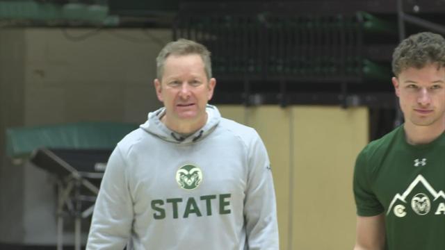
The Rams announced that they've reached a long-term extension with basketball coach Niko Medved. Medved has coached the Colorado State men's team since the 2018-19 and has had four 20+ win seasons during his tenure, include this past season.
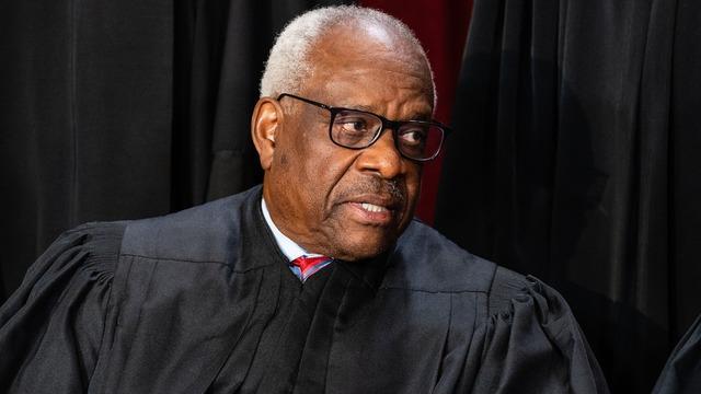
Justice Clarence Thomas did not attend oral arguments at the Supreme Court on Monday.

The investigation is being conducted by Maryland's U.S. Attorney's Office and the FBI.

The first criminal trial of a former president in U.S. history officially got underway in a crowded Manhattan courtroom, where jury selection has begun.

The historic criminal trial involving former President Donald Trump kicked off Monday, as he becomes the first former president in U.S. history to stand trial.

In a joint statement, twelve major news organizations, including CBS News, called on President Joe Biden and former President Donald Trump to commit to debates during the 2024 White House campaign.
Nearly 400 children in Colorado's foster care system are awaiting adoption, while over 6,000 Colorado kids remain in limbo, hoping to be reunited with their families.
Join CBS Colorado, 97.3 KBCO, and Raise the Future for A Day for Wednesday's Child. Anchor Mekialaya White will introduce viewers to many children still waiting for homes and will share success stories of those children who have found loving homes.
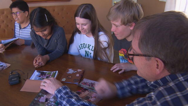
Raise the Future hosts a camp for families providing fun camp experience and intentional healing.
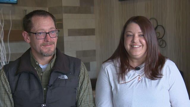
Mandie and John became foster parents and built a family.
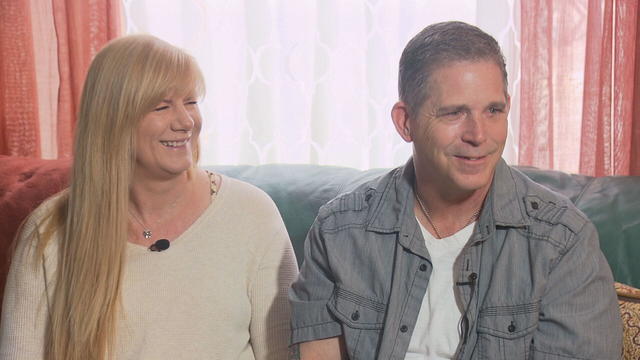
When Melanie & Layne decided to complete their family through adoption they turned to Raise the Future.
About 2.5% of Colorado's unemployment claims are currently held up on program integrity holds. That's almost 3,000 claims still in limbo, out of the 114,400 active unemployment claims in the state.
Hyundai owners have endured significant challenges in recent years, with some becoming victims of auto theft at least once.
The Investigators with CBS News Colorado have obtained new data showing just how many threats were in Denver Public Schools this year.
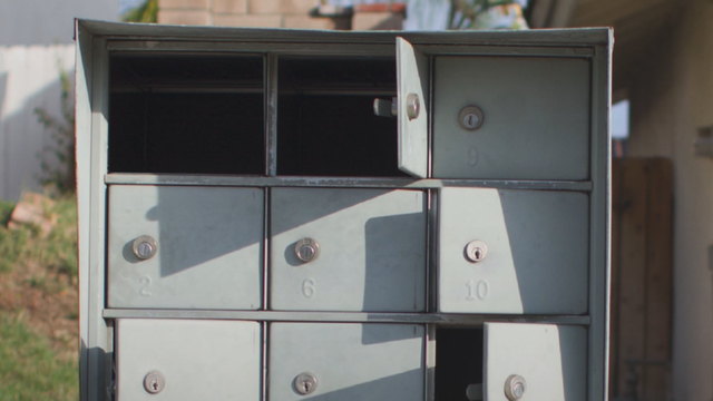
Mail theft complaints are on the rise in Colorado, in part, because of the key system used by the U.S. Postal Service. A closer look at the numbers revealed a widespread problem that federal officials believe is also leading to an increase in check fraud.
The former DoubleTree hotel at 4040 Quebec Street was converted to a shelter for the homeless in December 2023.

Consumer complaints have risen in recent months of unauthorized enrollment in Affordable Care Act coverage.
Social services, such as parenting classes and economic development programs, can help, some health experts say. But insurers don't always cover these services.
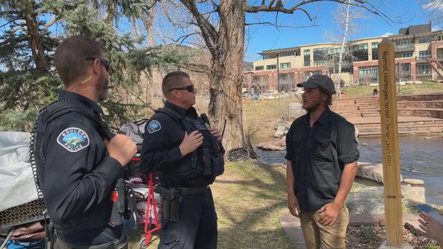
Two Boulder police officers in the department's Homeless Outreach Team talk about how people are often released when arrested on relatively minor charges as quickly as officers can complete the paperwork.
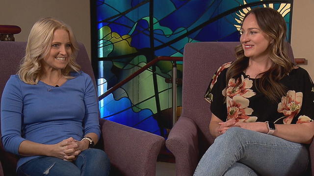
Donate Life Month promotes the importance of registering as an organ, eye and tissue donor. Two women know first-hand just how important organ donation can be.

Federal authorities are warning that unregulated Botox products are linked to an outbreak of botulism-like illnesses.
Just four months into the year, more than 7,400 people have applied for Denver's rental assistance program, TRUA.
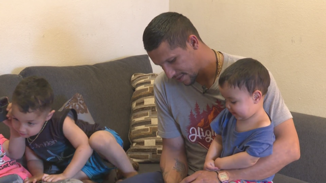
Many families who are newcomers to Denver are still struggling to find stability with housing and food.
Josh Scott is using his problem-solving skills to try to help schools absorbing large numbers of students from the southern border.
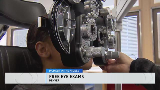
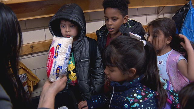
The organization Eye Love Care is helping McMeen Elementary School students with free eye exams.
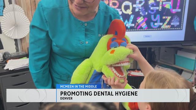
A dentist and hygienist visited McMeen Elementary to educate the students about the importance of dental hygiene.
About 2.5% of Colorado's unemployment claims are currently held up on program integrity holds. That's almost 3,000 claims still in limbo, out of the 114,400 active unemployment claims in the state.
One of the largest dams built in the United States in the last two decades is one year away from completion, a dam which will help supply water to Northern Coloradans for decades to come.
Alec Larson, a carpet cleaner and former volunteer firefighter, was among several good Samaritans who helped save a mother and young child from a burning car moments before it blew up. His act of bravery came five years after his own daughter died.
Families of those who were lost shared say on this day of remembrance they want to focus on the positive changes that have been made since that horrific day.
Denver's average last freeze is just over three weeks away.
Between getting out of the classroom, using the bathroom, waiting in line for food, waiting in line to pay and getting back to class on time, Colorado students often don't have enough time to eat their lunches. One state representative wants to form a task force to see how to change that.
One council member is also exploring how to introduce a ballot measure that would provide more safety requirements.
About 2.5% of Colorado's unemployment claims are currently held up on these holds. That's almost 3,000 claims still in limbo waiting for a review out of 114,400 active unemployment claims in the state.
Watch A Few More Minutes with former University of Colorado linebacker and NFL hopeful Jordan Domineck.
The Rams announced that they've reached a long-term extension with basketball coach Niko Medved. Medved has coached the Colorado State men's team since the 2018-19 and has had four 20+ win seasons during his tenure, include this past season.
It's that time of year, and Colorado Avalanche fans get to look forward to post-season hockey without having to sweat out the last few days of the regular season.
The Rams announced that they've reached a long-term extension with basketball coach Niko Medved. Medved has coached the Colorado State men's team since the 2018-19 and has had four 20+ win seasons during his tenure, include this past season.
The University of Denver will hold a celebration on Monday evening for its national champion men's hockey team.
The University of Denver men's hockey team doesn't like to use the term dynasty, but with 10 NCAA national titles, they have solidified their place in college hockey history.
World no. 1 Scottie Scheffler finished 11 under to win his second Masters Tournament in three years Sunday.

In the 1,000th episode, titled "A Thousand Yards," NCIS comes under attack by a mysterious enemy from the past.
Justice Clarence Thomas did not attend oral arguments at the Supreme Court on Monday.
Consumer complaints have risen in recent months of unauthorized enrollment in Affordable Care Act coverage.
The investigation is being conducted by Maryland's U.S. Attorney's Office and the FBI.
The first criminal trial of a former president in U.S. history officially got underway in a crowded Manhattan courtroom, where jury selection has begun.
Justice Clarence Thomas did not attend oral arguments at the Supreme Court on Monday.
The investigation is being conducted by Maryland's U.S. Attorney's Office and the FBI.
The first criminal trial of a former president in U.S. history officially got underway in a crowded Manhattan courtroom, where jury selection has begun.
The historic criminal trial involving former President Donald Trump kicked off Monday, as he becomes the first former president in U.S. history to stand trial.
In a joint statement, twelve major news organizations, including CBS News, called on President Joe Biden and former President Donald Trump to commit to debates during the 2024 White House campaign.
Consumer complaints have risen in recent months of unauthorized enrollment in Affordable Care Act coverage.
Social services, such as parenting classes and economic development programs, can help, some health experts say. But insurers don't always cover these services.
Two Boulder police officers in the department's Homeless Outreach Team talk about how people are often released when arrested on relatively minor charges as quickly as officers can complete the paperwork.
Donate Life Month promotes the importance of registering as an organ, eye and tissue donor. Two women know first-hand just how important organ donation can be.
Federal authorities are warning that unregulated Botox products are linked to an outbreak of botulism-like illnesses.
Consumer complaints have risen in recent months of unauthorized enrollment in Affordable Care Act coverage.
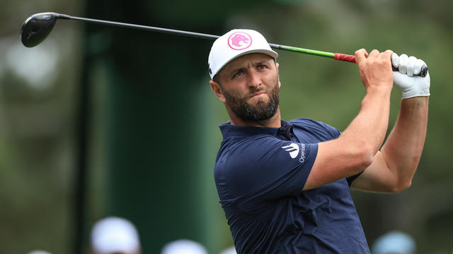
Here's how much the winner took home last year, and what other golfers made.

Beware of taking dubious tax advice from unqualified creators on social media, say experts. Following wrong advice could potentially lead to fines.
Federal authorities are warning that unregulated Botox products are linked to an outbreak of botulism-like illnesses.

A British television broadcaster blasted Apple for the conspicuous flaw, accusing the company of antisemitism.

You've probably noticed recently the amount or quantity in a package of food or house supplies is decreasing, while the price is increasing.
Receiving a phone call with information saying it's your loved one on the other line can be harmless. However, it could be part of an elaborate plan from a scammer.
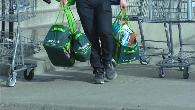
Inflation is cooling right now, but the prices of groceries and food are still rising. For example, the latest CPI data shows that grocery store prices are 25% higher than in January 2020.
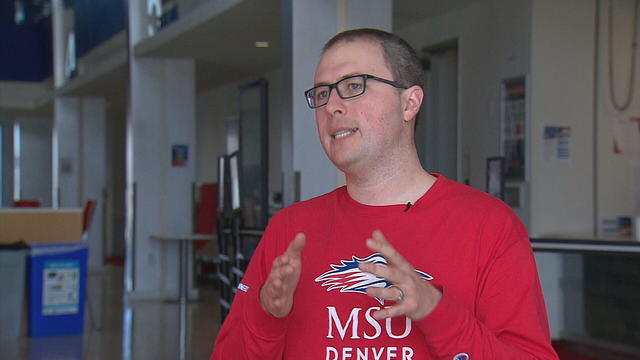
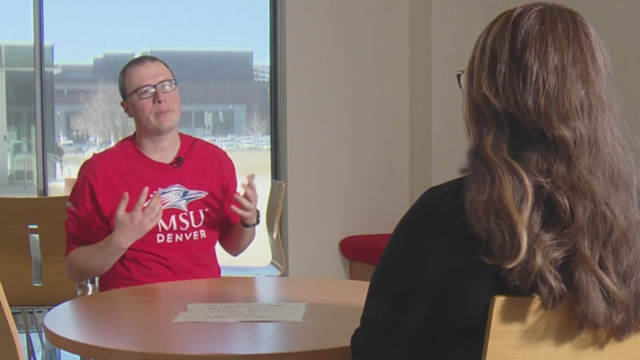
MSU Denver students have a direct hand in helping Colorado taxpayers get their taxes filed and done.

More help is on the way for Coloradans struggling to pay their rent. It's through the state's Temporary Rental Assistance Grant and the first deadline of the year for pre-applications is at 5 p.m. Tuesday.