CBS News Live
CBS News Colorado: Local News, Weather & More
Watch CBS News
Covering Colorado First

Some pro-Palestinian protesters on the Auraria Campus in downtown Denver were detained on Friday afternoon.

Donors are being honored during the month of April along with their families who agree to donate an organ, eye, and tissue.
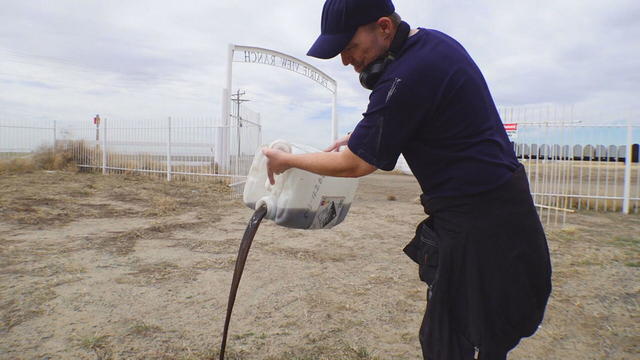
Certified lab results show the water system's black sludge is filled with radioactive lead and uranium

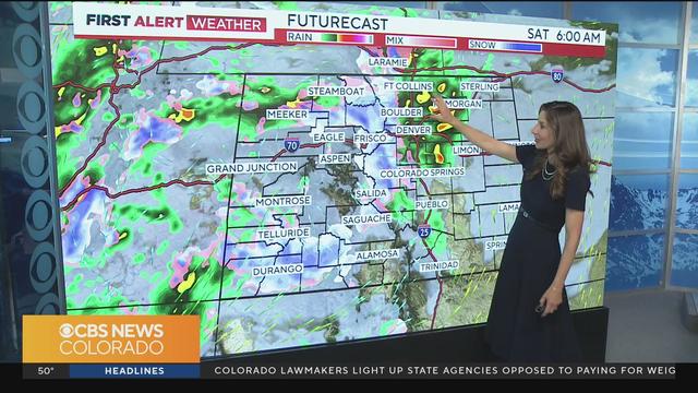
Get your raincoat ready and grab that umbrella as much needed moisture arrives tonight into the weekend.
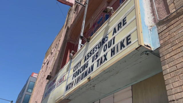
In the 70s, it was a place where Chicanos would gather and catch Spanish-American films, then in the late 80s the theatre became a space for live shows and concerts.

Film on the Rocks also includes live performances along with the beloved films under the stars at the iconic Red Rocks Park & Amphitheatre.
An Aurora family is speaking out after one of their loved ones was arrested for allegedly walking onto a school playground and attempting to kidnap a child.
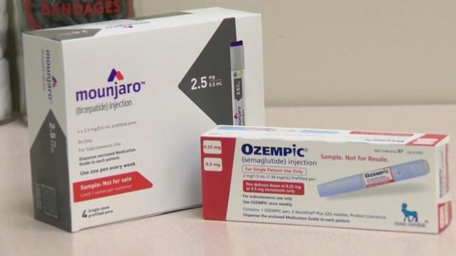
A bill that would require state-regulated insurers and Medicaid to cover weight loss drugs for people who are obese or prediabetic cleared a major hurdle at the Colorado State Capitol.

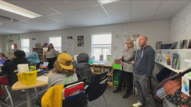
Teenagers in the Poudre School District are learning to better handle and process their emotions thanks to a new partnership with Colorado State University.
Watch meteorologist Callie Zanandrie's forecast.

The Denver Broncos selected quarterback Bo Nix with No. 12 pick in first round of NFL Draft.

The Denver Nuggets superfan who has been banned from games at Ball Arena has filed a lawsuit against Kroenke Sports and Entertainment.

For Northglenn High School junior Elle Taylor, playing flag football was never something she could have imagined doing as a sport in Colorado.

After goalie Alexandar Georgiev allowed seven goals on 23 shots in Sunday's loss, he said his teammates went out of their way to help him. That support proved key in Georgiev's bounce-back game on Tuesday night.
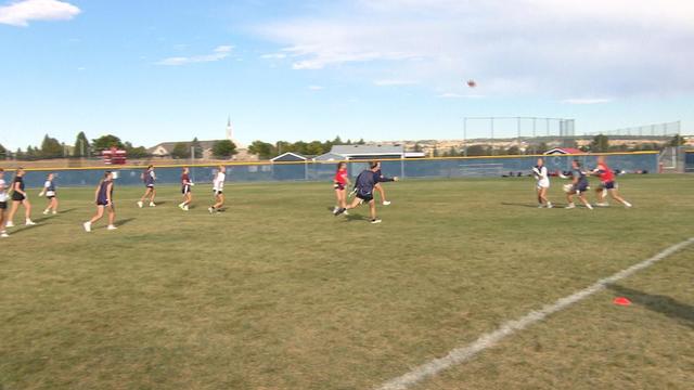
The Colorado High School Activities Association voted to sanction girls flag football as a permanent high school sport.

Donors are being honored during the month of April along with their families who agree to donate an organ, eye, and tissue.
Denver students participated in the Safe City Youth Summit on Friday.
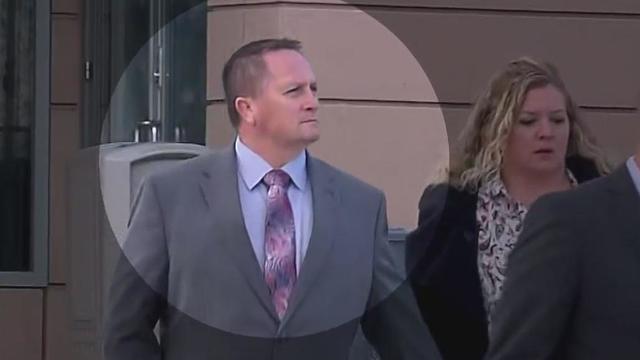
Sentencing scheduled Friday afternoon for Jeremy Cooper who was convicted of criminally negligent homicide in the death of Elijah McClain.
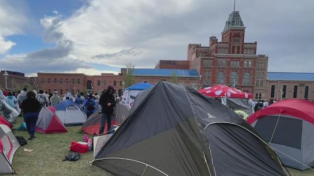
Students on the Auraria campus say they want college administration to take a stance against the war in Isreal.
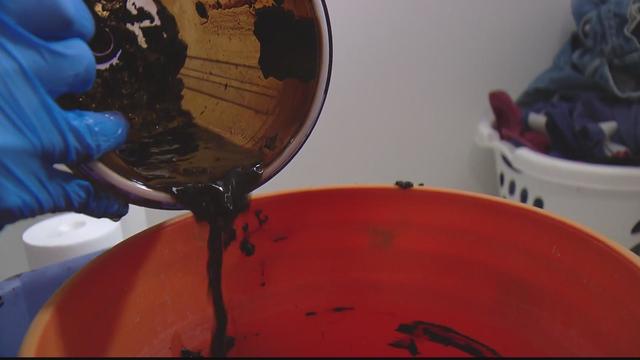
Certified lab results show the sludge in the water is filled with radioactive lead and uranium.
A bill that would require state-regulated insurers and Medicaid to cover weight loss drugs for people who are obese or prediabetic cleared a major hurdle at the Colorado State Capitol.

Coal-fired power plants would have to capture smokestack emissions or shut down under a new EPA rule the industry says would make the grid less reliable. It's likely to face court challenges.

An Arizona grand jury indicted 18 people in connection with an alleged attempt to use alternate electors after the 2020 election.

Two sources briefed on the situation told CBS News the agent spouted gibberish, was speaking incoherently and provoked another officer physically.

Four-year-old Abigail Mor Edan was held by Hamas for 50 days and was the youngest American hostage released by Hamas.
CBS News Colorado spoke with two Department of Corrections employees who asked to remain anonymous but sounded the alarm on the issue in March.

Families of people with long-term disabilities allege dysfunction and chaos within Colorado's Medicaid offices are failing the state's most vulnerable populations.

Two more family members have been arrested and charged with abuse of a developmentally disabled man in their care. Witnesses say they beat, choked, kicked and punched a relative who functions at the level of a 5- to 8-year-old.

A 65-year-old Colorado woman appears to be the latest victim of a widespread romance scam known as the "Keanu Reeves Scam."

When Denver Fire Department Technician Jeff Billingsley, 42, died on duty on September 20, 2021, he was remembered as a man who began working in the fire service while still in high school and was devoted to service for his professional career.
Certified lab results show the water system's black sludge is filled with radioactive lead and uranium

Are you using your smartwatch to the fullest? Here are 4 metrics doctors say can be useful to track beyond your daily step count.
A bill that would require state-regulated insurers and Medicaid to cover weight loss drugs for people who are obese or prediabetic cleared a major hurdle at the Colorado State Capitol.
Teenagers in the Poudre School District are learning to better handle and process their emotions thanks to a new partnership with Colorado State University.
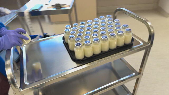
The Mothers' Milk Bank helps countless families in Colorado. For the past 40 years, it's been a critical resource for families.
Just four months into the year, more than 7,400 people have applied for Denver's rental assistance program, TRUA.
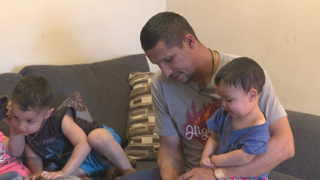
Many families who are newcomers to Denver are still struggling to find stability with housing and food.
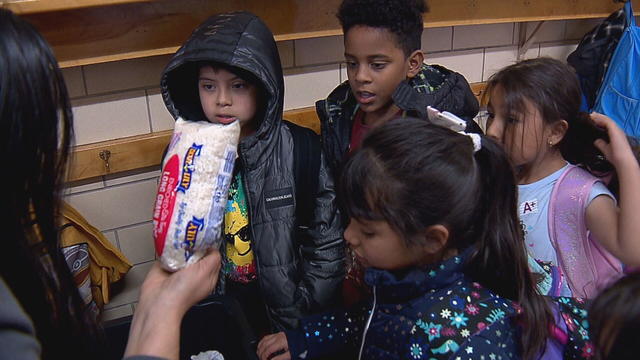
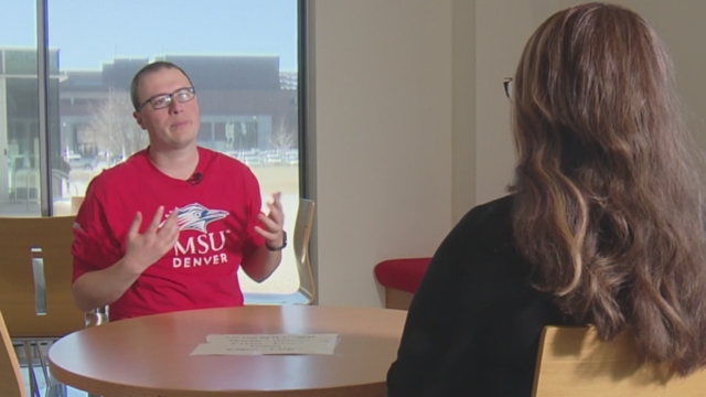
Josh Scott is using his problem-solving skills to try to help schools absorbing large numbers of students from the southern border.
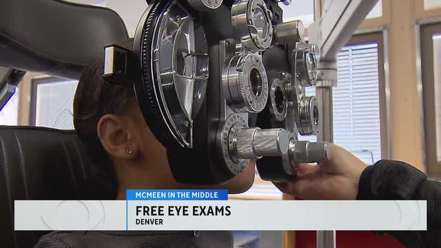
The organization Eye Love Care is helping McMeen Elementary School students with free eye exams.
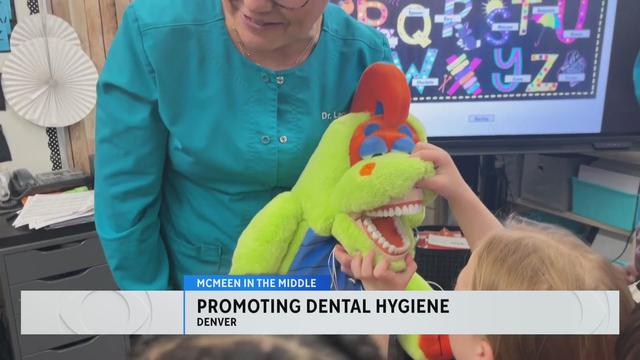
A dentist and hygienist visited McMeen Elementary to educate the students about the importance of dental hygiene.
Some pro-Palestinian protesters on the Auraria Campus in downtown Denver were detained on Friday afternoon.
Donors are being honored during the month of April along with their families who agree to donate an organ, eye, and tissue.
Certified lab results show the water system's black sludge is filled with radioactive lead and uranium
Get your raincoat ready and grab that umbrella as much needed moisture arrives tonight into the weekend.
In the 70s, it was a place where Chicanos would gather and catch Spanish-American films, then in the late 80s the theatre became a space for live shows and concerts.
Donors are being honored during the month of April along with their families who agree to donate an organ, eye, and tissue.
Denver students participated in the Safe City Youth Summit on Friday.
Sentencing scheduled Friday afternoon for Jeremy Cooper who was convicted of criminally negligent homicide in the death of Elijah McClain.
Students on the Auraria campus say they want college administration to take a stance against the war in Isreal.
Certified lab results show the sludge in the water is filled with radioactive lead and uranium.
The Denver Broncos selected quarterback Bo Nix with No. 12 pick in first round of NFL Draft.
The Denver Nuggets superfan who has been banned from games at Ball Arena has filed a lawsuit against Kroenke Sports and Entertainment.
For Northglenn High School junior Elle Taylor, playing flag football was never something she could have imagined doing as a sport in Colorado.
After goalie Alexandar Georgiev allowed seven goals on 23 shots in Sunday's loss, he said his teammates went out of their way to help him. That support proved key in Georgiev's bounce-back game on Tuesday night.
The Colorado High School Activities Association voted to sanction girls flag football as a permanent high school sport.

A new rule will affect frozen breaded and stuffed raw chicken products that appear to be fully cooked but are only heat-treated.

The median mortgage payment jumped to a record $2,843 in April, up nearly 13% from a year ago, a new analysis finds.

U.S. regulators are reviving a rescinded rule, laying the groundwork for for a major court fight with the broadband industry.

Visitors will have to pay five euros, a fee designed to offset some of the costs of accommodating tourists.

PayPal payments are being made to 117,044 consumers whose videos may have been accessed by unauthorized users.
A bill that would require state-regulated insurers and Medicaid to cover weight loss drugs for people who are obese or prediabetic cleared a major hurdle at the Colorado State Capitol.
Coal-fired power plants would have to capture smokestack emissions or shut down under a new EPA rule the industry says would make the grid less reliable. It's likely to face court challenges.
An Arizona grand jury indicted 18 people in connection with an alleged attempt to use alternate electors after the 2020 election.
Two sources briefed on the situation told CBS News the agent spouted gibberish, was speaking incoherently and provoked another officer physically.
Four-year-old Abigail Mor Edan was held by Hamas for 50 days and was the youngest American hostage released by Hamas.
Certified lab results show the water system's black sludge is filled with radioactive lead and uranium
Are you using your smartwatch to the fullest? Here are 4 metrics doctors say can be useful to track beyond your daily step count.
A bill that would require state-regulated insurers and Medicaid to cover weight loss drugs for people who are obese or prediabetic cleared a major hurdle at the Colorado State Capitol.
Teenagers in the Poudre School District are learning to better handle and process their emotions thanks to a new partnership with Colorado State University.
The Mothers' Milk Bank helps countless families in Colorado. For the past 40 years, it's been a critical resource for families.
A new rule will affect frozen breaded and stuffed raw chicken products that appear to be fully cooked but are only heat-treated.

The National Highway Traffic Safety Administration is investigating whether last year's recall of Tesla's Autopilot driving system did enough to make sure drivers pay attention to the road.
The median mortgage payment jumped to a record $2,843 in April, up nearly 13% from a year ago, a new analysis finds.
U.S. regulators are reviving a rescinded rule, laying the groundwork for for a major court fight with the broadband industry.
Visitors will have to pay five euros, a fee designed to offset some of the costs of accommodating tourists.
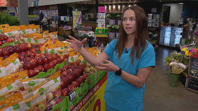
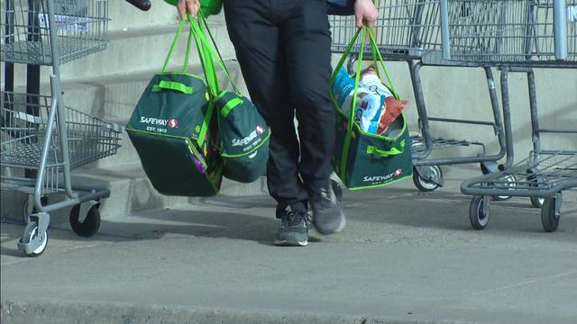
Eating a healthy, balanced diet when money is tight can be tough. And it's no secret that food costs have skyrocketed within the past year. According to the U.S. Department of Agriculture, food costs in 2023 rose 5.8%.
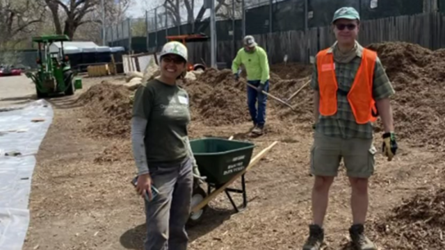
A Denver nonprofit that works with communities to plant trees and improve parks is having a special giveaway, providing trees for free and at a discount.

You've probably noticed recently the amount or quantity in a package of food or house supplies is decreasing, while the price is increasing.
Receiving a phone call with information saying it's your loved one on the other line can be harmless. However, it could be part of an elaborate plan from a scammer.
Inflation is cooling right now, but the prices of groceries and food are still rising. For example, the latest CPI data shows that grocery store prices are 25% higher than in January 2020.